

The purpose of the Geographic Information, Environment, Territorial and Urban Planning Subsystem –SIGMAOT- aims to produce, integrate, generate and d
The purpose of the Geographic Information, Environment, Territorial and Urban Planning Subsystem –SIGMAOT- aims to produce, integrate, generate and disseminate the statistical and geographic information that is required for the adequate planning, implementation and monitoring of state policies in matters of sustainable planning of resources
Da click en el link al final de la nota para leer en español:

Guanajuato/Gto News
In Guanajuato, geographic information is highly relevant in decision making.

The State Government, through the Ministry of the Environment and Territorial Planning -SMAOT-, allows, among other benefits, territorial planning, protection of natural resources, as well as the prevention and control of environmental pollution.
The Geographic Information and Environment Subsystem of the State of Guanajuato, developed by the SMAOT, has allowed great improvements in the capture, processing, use and dissemination of geographic data for education organizations, private initiative and government.

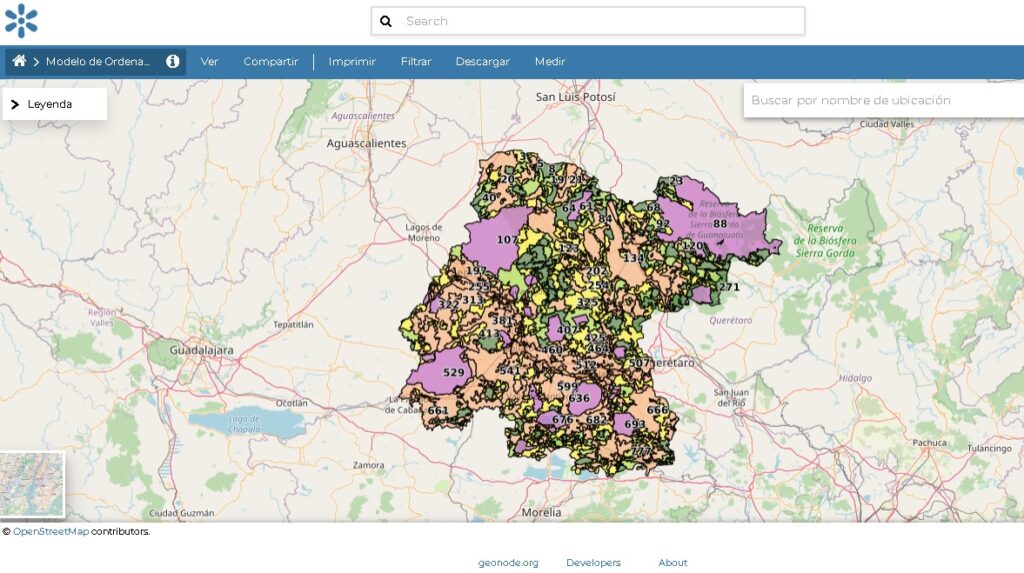
For the State Government, it is extremely important to generate and maintain standardized, homogeneous, updated geographic information that meets quality standards, that can be interchangeable and that serves, among other things, for the definition of public policies, integrating the information of the Inventories of Housing, Land and Housing, Forestry and Protected Natural Areas.
Based on article 215 of the Territorial Code for the State and Municipalities of Guanajuato, the SMAOT Node was developed, its goal is to produce, integrate, generate and disseminate the statistical and geographic information that is required for the adequate planning, instrumentation and monitoring of state policies.

Open source software was used for the construction of this portal.
The cartographic information is freely available online in shapefile format and in two reference systems:
- Geographic coordinates (degrees, minutes and seconds)
- Metric coordinates (Lambert Conformal Conic or Universal Transverse Mercator) with DATUM WGS84 parameters

To access this service go to:
En Español: